

Field guide
Monday, October 26, 2026
The Schuylkill Banks south end - a fall walk from Center City to the Grays Ferry Crescent
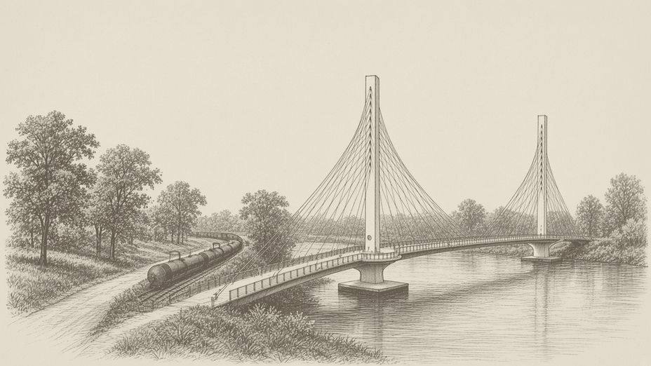
Most of us know the Schuylkill River Trail as the stretch up by the Art Museum and Boathouse Row. The south end is the part a lot of Center City, Graduate Hospital and South Philly neighbors still haven't walked, and it changed in a big way last year.
Most of us know the Schuylkill River Trail as the stretch up by the Art Museum and Boathouse Row. The south end is the part a lot of Center City, Graduate Hospital and South Philly neighbors still haven't walked, and it changed in a big way last year. Since May 2025 you can stay on the riverbank from Center City all the way down to the Grays Ferry Crescent without ever stepping onto a city street.
Early November is a good time to finally do it. The trees along the river are turning, and it's a lot quieter than summer.
What you're walking on
"Schuylkill Banks" is the name for the tidal part of the Schuylkill, the bottom eight miles of the river below the Fairmount Dam down to the Delaware. The City owns it and Philadelphia Parks & Recreation runs it. The Schuylkill River Development Corporation, a nonprofit that goes by SRDC, helps plan it, build it, maintain it and program it.
Tidal is the word to remember. The river down here rises and falls with the tide, so it looks different depending on when you show up.
How it got here
The trail started as a neighborhood ask. According to SRDC's history, Fitler Square neighbors pushed for Schuylkill River Park at 25th and Spruce in the 1980s. A landscape architect named John Collins then proposed a long, skinny park along what was mostly an abandoned riverfront. A neighborhood group formed in 1992 to push for it, and the City's Streets Department cleared the bank and paved a trail between Locust Street and MLK Drive. That group later became today's SRDC.
So the path under your feet is something your neighbors asked for.
The walk, north to south
Start anywhere along the Center City stretch around Walnut or Locust and head downriver, with the water on your right.
The first part is the older Center City section. You'll pass the Walnut Street Dock, where SRDC's kayak tours launch in season and paddle up to the Fairmount Water Works and back. South of Locust, the trail goes out onto the boardwalk that was built over the water where the railroad tracks squeeze the bank, and it brings you down to the South Street Bridge.
Keep going past South Street and you're on the stretch down toward Christian Street. For years, this is where the trail ended for anyone headed south.
The new bridge
The Christian to Crescent section opened on May 17, 2025. It runs along the east side of the river from near Christian Street to the north end of the Grays Ferry Crescent at 34th Street, and SRDC says it closed a 2,812-foot gap in the Schuylkill River Trail.
The big piece is a 650-foot cable-stayed bridge that runs along the east bank of the river. The City says the cables are strung in a woven-harp pattern that's the first of its kind in Pennsylvania. The deck is 25 feet wide, with seating spots and overlooks at each of the two towers. Stop at one of those overlooks and look back north at the skyline.
The section also has trail lighting, benches, new trees and flowering perennials. At the south end there's a tunnel under the 34th Street Bridge into the Crescent, plus a new accessible entrance up at 34th Street.
The Grays Ferry Crescent
The Crescent follows the curve of the riverbank from 34th Street to Wharton Street on the South Philly side. It opened in June 2012 on about 11 acres.
The land had a rough past. SRDC says it was used for industrial and chemical purposes for more than a century and was known as the DuPont Crescent. Before the trail could go in, SRDC led a cleanup starting in fall 2008 that hauled out contaminated soil and paving and put down new soil and seed.
Today it's lawns, native-grass meadows and riverfront plazas, with a pier where people fish. In November the meadows go tan and seedy, and that's a nice time to just sit on a bench for a while.
Where it stops, for now
Stand at the south end of the Crescent and look across the river. That's Bartram's Garden on the other bank. The link between them is the Schuylkill Crossing, a new swing bridge just south of the Grays Ferry Avenue Bridge, where an old railroad swing bridge stood until it was taken apart in 2018.
It has to swing because the river below Grays Ferry is still a working waterway, and boats need to get through. SRDC's project page, which I checked this week, still says it's under construction with a projected opening in fall 2026. I haven't seen an opening day announced. You can see it from the Crescent, so take a look and watch Schuylkill Banks for the news.
How long it takes
I'd budget an hour or two for the round trip from the Walnut Street area to the far end of the Crescent at an easy pace, with stops. I didn't measure it, so check SRDC's trail map if you want exact distances.
Getting there and the practical stuff
- The Center City end is an easy walk from Rittenhouse and Fitler Square. SRDC's Explore the Trail page has a map of access points and parking.
- At the south end, use the 34th Street entrance or come in from the Grays Ferry side of the Crescent.
- Walkers, runners and bikes all share the path. Keep right, pass with a heads-up, and keep dogs close.
- I didn't find restrooms listed on the trail pages, so plan for that.
- SRDC posts closures and repairs on its news page. Check it before you go.
- It's a shared path past people's homes and workplaces, so keep the volume down, pack out your trash, and stay out of the swing bridge construction area.
A few things to look for in November
The skyline from the middle of the new bridge is the obvious one. Down on the Crescent, look at how much of the old industrial edge is meadow now. Keep an eye out for herons too. They were already showing up in the Crescent's meadows when it opened.
The short version
The south end of the Schuylkill Banks now runs unbroken from Center City to the Grays Ferry Crescent, thanks to a 650-foot bridge that opened in May 2025. Walk downriver from Walnut Street, cross the new bridge, and finish in the Crescent's meadows, a former DuPont industrial site that's now lawns and a fishing pier. Bartram's Garden is right across the water, and the swing bridge that will connect them is still under construction.